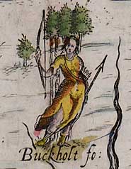
Michael Drayton's allegorical representation of Buckholt Forest, Hampshire, in
Poly-Olbion
An Gazetteer of Forests and Chases
![]() The Gazetteer
represents a summary part of the on-going collection of data for the
project, the largest yet compiled on the known forests
and chases of England and Wales, currently just short of 1,000 in total.
The Gazetteer
represents a summary part of the on-going collection of data for the
project, the largest yet compiled on the known forests
and chases of England and Wales, currently just short of 1,000 in total.
How to use the Gazetteer. The data is presented in spreadsheet format, as a Excel .xls file. This can be opened in Microsoft Excel and also in Open Office Calc. First, click on the spreadsheet to 'select' it and then use the lugs on its sides and corners to open it out for the width and depth that is most convenient for your monitor. You can then use it in the normal way. Use the scoll-bars to move up and down and from side to side. Columns can be widened or made narrower by clicking and dragging their side borders. Hidden contents of a cell can be revealed by selecting the cell and single clicking on the text. Auto-filter is turned on (the down-pointing arrows alongside the field names) to allow searching within columns. The tools bar provides the means of sorting. Please be aware that this is work in progress.