|
|
An Atlas and Gazetteer of Forests and Chases
|
|
|
|
|
A list of OS One-Inch sheets and the forests and/or chases on each The list is not yet definitive. Abbreviation: aka = also known as.
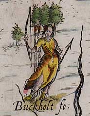
1-69 [Scotland] 70 Kidland, Redesdale, Emblehope 71 Cheviot, Aydon, Rothbury 75 Allerdale (aka West Ward of Inglewood) 76 Liddel (aka Nichol), Askerton North Moor, Bruthwaite (aka Tyndaleside), Geltsdale 77 Lowes, Westwood, Low, Bywell and Bulbeck 78 �The Wood of St Cuthbert between Tees and Tyne� 79 [Scotland] 80 [Scotland] 81 [Scotland] 82 Allerdale, �Land between Pallet and Uldale�, Skiddaw, Derwentfells, Castlerigg, Copeland 83 Inglewood, �Land east of River Eden�, Gilderdale, Milburn, Ralfland, Martindale, Greystoke, Grisedale and Glencoyne, Kendal 84 Milburn, Gilderdale, Allendale, Edmundbyers, Muggleswick Park.
Weardale, Harwood, Teesdale, Stanhope Park, Wolsingham Park, Lune, Crosthwaite,
Mickleton, Cotherstone, Lartington, Marwood Hagg, 85 Aldwood, Auckland Park, Evenwood Park, �The Wood of St Cuthbert between Tees and Tyne� 86 Stokesley, Westerdale and Baysdale, Danby, Eaton, Whitby 87 [Isle of Man] 88 Ulpha 89 Kendale, Ulpha, Furness, Bannisdale aka Fawcett, Dent, Mewith, Roeburndale, Quernmore (in Lonsdale) 90 Mallerstang, Swaledale, Fremington, Wensleydale, Bishopdale, Coverdale, Nidderdale, Langstrothdale, Littondale, Burton 91 Applegarth, Allertonshire 92 Westerdale and Baysdale, Danby, Egton, Spaunton aka Farndale, Pickering 93 Scalby 94 Lonsdale inc. Wyresdale; Amounderness inc. Myerscough, Fulwood
95
Roeburndale, Quernmore and Wyresdale, Bowland, Gisburn, Pendle, Middop Moor,
Trawden, Rossendale, Accrington, Hoddesdon, 96 Knaresborough, Sowerbyshire aka Hardwick 97 Galtrees 98 Hatfield 99 [None yet identified] 100 West Derbyshire inc. Simonswood, Croxteth Park, Toxteth Park, Burtonwood 101 Horwich 102 Holme, Peak, Rivelin(g)(dene), Fullwood, Wharncliffe 103 Barnsdale, Hatfield, Luddington 104 Luddington, Between Gringley and Wheatley. 105 [None yet identified] 106 Snowdon (Craig Eyri), Anglesey 107 Snowdon (Craig Eyri), Uwch Dulas, Is Dulas 108 Is Aled, Uwch Aled, Dinmael, Denbigh, Ceinmeirch, Bach y Graig, Tyddin, Flint, Soughton, Ewloe, Trueddyn or Moldsdale, Bistre, Garthbridoke Blorent, Nantwragh Marghnant?, Cadenant, Rhuthun, Bod y Groes, Bron Bannog, Derwen, Eyarth, Llys Llannergh, Faenol, Brithdir Glyn, Llwyn y Brain, Bromfield and Yale, Isclawdd, Cwm Cathi. 109 Wirral, Delamere 110 Delamere, Macclesfield, Leek Frith 111 Peak, Malbon Frith, Duffield Frith 112 Sherwood 113 Tattershall 114 Tattershall 115 Snowdon (Craig Eyri) 116 Snowdon (Craig Eyri), Prysor, Cefn Rhystlys and Fridd Gulcwm 117 Glynceiliog (?), Carregnant, Bodlith, Mochnant, Banhadla, Coed-y-Gaer, Trefonen, Trevelegh, Crickheath, Llan-y-Mawddwy 118 Babbinswood, Middle, Haughmond aka Kingswood (detached part of Wrekin aka Mount Gilbert), Shrawardine, Breidden, Corndon, Hayes, Heath, Caus, Hogstow, Luckley, Stiperstones, Hockelton, Long 119 New inc. Lightwood, Cannock, Brewood, Wrekin aka Mount Gilbert 120 Needwood, Cannock 121 Charnwood, Leicester 122 Leicestershire and Rutland inc. Leighfield 123 Kesteven, Soke of Peterborough 124 Castle Rising 125 [None yet identified] 126 Horsford, Catton (?), Eaton (?), Framingham (?) 127 Snowdon (Craig Eyri), Ystumanner, Cefn ar Ddeg, Tafolwern, Cwm Buga, Plimlimon and Gwain Dranon (jointly or separately), Forest in Geneu�rglyn, 128 Corndon, Dolforwyn, Tregynon, Llanllwchaiarn, Penstrowel, Penprys, Esgaer y Maen, Talgarth, Trefeglwys, Dinas, Ceri, Clun, Tempsett, Hirthhowell, Glyntoloch, Knucklas, Bleddfa, Fforest Fach, Ackwood, Cwmygerwyn, Radnor, Maelienydd 129 Corndon, Stiperstones, Long, Mogg, Seifton, Clee, Carewood (?), Hope, Portloke, Mocktree, Bringewood, Deerfold, Norwood, Bradnor 130 Shirlett, Morfe, Wyre, Kinver, Pensnett, Pepperwood, Feckenham, Ombersley 131 Sutton Coldfield, Kenilworth, Feckenham 132 Arden (Merevale), Leicester 133 Leicestershire and Rutland inc. Leighfield, Rockingham, Salcey, Bromswold 134 Rockingham, Bromswold, Weybridge, Somersham, Sapley 135 Somersham, Methwold 136 Thetford 137 (?Huntingfield) 138 Priskilly, Rhigian 139 Pencelly, Forest in Uwch Nyfer, Llwydarth, Llesnewydd, Atpar, Blaen Cwn, Cerdin, Blaen-y-than, Cilgerran or Cefn Drym, (Penboyr?), Garth Gwyddyl, Glyncothi, Cardyth, 140 Nantcwnlle, Four Forests of Tremynt or Llanddweibrefi aka Fforest yr Escob, Forest at Berth Lwyd in Lampeter, Upper, Forest in Llangybi (?), Glyncothi, Pullkinbye (?), Pennant, Killardun, Cwmbawddwr, Cwmmawr, Crugyblaidd, Cefn-Gelevartn, Bethel, Brecon Great Forest 141 Talyfan aka Ff Twdin, Old in Is Mynydd, Newydd in Is Mynydd, Bryngwyn (?), Brilley, Brecon Great Forest, Brecon Fforest Fach, Cae Fadog (?), Cadelan, Llanfrynach, Llanfeugan, Forest on Bryniau Gleision in Llandetty, Trallong, Upper in Cantref Selyf, Lower in Cantref Selyf, Erwood, Coed-y-Ffrith (?), Bychlyd, Hay, Dinas aka Ffynnant aka Talgarth, Heol David Coch, Myarth, Crickhowell (including Llanbedr, Ffawyddog, Clydach, and Aberbaidan), Hen, Monmow, Olchon, Moelyfan 142 Ewyas, Hene aka Ewyas Lacey, Monmow, Hadnock, Treville aka Kilpeck, Hay of Hereford, Aconbury, Harewood, Meolyfan, Penyard, Dean 143 Dean, Ledbury, Malvern, Horwood, Feckenham 144 Feckenham, Whichwood aka Wychwood 145 Whichwood aka Wychwood; Forest Between the Bridges of Oxford and Stamford inc. Shotover, Bernwood; Whittlewood 146 Forest Between the Bridges of Oxford and Stamford inc. Bernwood, Whaddon (inc. Horwood?); Whittlewood; Salcey 147 Moddry 148 Hatfield (in Essex) 149 Kingswood (in Essex) 150 Essex 151 Venallt, Narberth 152 Narberth, Coidrath, Cardyth, Forest in Gwarhaf, Forest (Wen?) in Penrhyn, Cligyn, Treskech, Wenallt, Kidwelli, Glynne, Glynne-iskin, Coed Mawr, Penrhyn (submerged) 153 Pencoed, Glyn Istyn, Llanedy aka Cefn Gorach, Gellifeisant, Clyne, Kevan, Trewyddfa, Kilvey, Farwood (?), Torchyclydwen, Gwain Oyner (?), Vorgan, Bethel, Pedol, Glanamman, Maes Cathelog, Coed-ffrank, Fforest-goch, Forest at Farteg in Cilybebyll, Forest at Abergarwed, Llafan Du, Blaen Glyncorrwg, Margam, Castell Lloyn, Newton Nottage, Brecon Great Forest 154 Forest (?Stock) in Llangynwyd, Forest (Pwll Du?) in Llangynwyd, Forest at Coedcae-y-Derlwyn in Glyncorrwg, Llanblethian (aka Llanwethian aka Witherside?), Forest (?Talyfan), New aka Yburye at Ystradowen in Talyfan, Garth Maelwg, Forest in Glyn Rhondda (?Rotheny), Old aka Fach at Talygarn in Penychen, Gellynog, Meisgyn (lordship), Coed Marchan, Glyn Taff, Forest at Meisgyn, Llwydcoed (aka Hirwaun?), Senghenydd (lordship), Y Fid, Bychan in (?Y Fid), Fawr in (?Y Fid), Newydd in (?Y Fid), Cefn Onn, Coed Craig Ruperra (?), Gwladys (Cefn y Fidd?), Forest at Cwm Cothi in Treharris, Gwynllwg (?), Machen, Allt Griffith, Oakington, Coed Breint, Tillery, Hirwaun, Ynys y Vago, Tylor, Goch, (Cilfynnyd?) 155 Caldicot, Wentwood, Coed Cwnwr, Llangybi, Gwehelog, Wisewood, Dean, Tidenham, Horwood 156 Kingswood, Dean 157 Braydon, Chippenham, Melksham 158 Berkshire, Shotover 159 Windsor (in Berkshire) 160 Hatfield 161 Essex (including Epping, Hainault, Writtle) 162 Essex 163 Exmoor 164 Exmoor 165 Mendip, Filwood, North Petherton 166 Selwood, Mendip, Gillingham 167 Chippenham and Melksham, Selwood, Savernake, Chute, Grovely, Cranborne, Clarendon, Melchett 168 Buckholt, Bere Ashley, Chute, Fremantle, Pamber, Windsor, Alice Holt, Humbledon 169 Windsor, Alice Holt 170 Windsor, Hampton Court 171 Whitley, Southfrith 172 Hoathe, �Forest� (near Ashford) 173 Blean, Rivingwood, Haradun, Buckholt (?) 174 Cornwall, Devon 175 Dartmoor with Devon 176 Devon 177 Neroche, Somerton, Powerstock 178 Blackmore, Bere Regis, Purbeck 179 Cranborne, Stourfield, Purbeck, Holt, Wimborne, Badbury 180 New, Parkhurst, Waltham, East Bere, Pernhill Wood 181 Woolmer, East Bere, Arundel (inc. Stansted, Broyle, Singleton, Charlton, Houghton) 182 St Leonards, Worth 183 Ashdown, Waterdown, Dallington, Broyle, Dicker 184 Oxney 185 Cornwall 186 Cornwall 187 Cornwall, Dartmoor with Devon 188 Devon 189 Cornwall 190 Cornwall
|
Both of the index maps above are 'clickable' - hovering the cursor over any part of them will activate a label identifying an underlying map which shows that area at a larger scale. Clicking will then activate that underlying larger scale map. Use the browser's 'Back' button to return to this page. This research tool is work in progress, so please be patient. Future funding will enable the outlines to be hot-linked to data about particular forests and chases such as historical provenance, officers, courts, and infrastructure, references in published work, images, and links to further information. The map on the left performs as a gateway to the project's mapping of forests and chases and associated features in the areas of individual Ordnance Survey one-inch-to-the-mile sheets. Click on individual sheet tiles to view outlines of the forests and chases so far identified in a particular area. To locate a forest or chase by sheet number, consult the list below. What the maps show: The greatest extent of a forest or chase is shown by a solid black line, its reduced area(s) by broken black lines, and where the bounds are not known by dotted ellipses. Forest names are shown in large italic letters. Blue lines indicate the extents of relevant lordships, baronies, and other large land units (such as cantrefs and commotes in Wales). County boundaries are in yellow. Further explanatory text will be added to accompany individual maps. Please be aware that the maps do not show all the information mapped by the project. The full mapping is archived as a set of Corel Draw files, due for release on the completion of the project. The map on the right gives access to mapping of forest outlines across regions. The first click opens one of three large regional maps, Northern England, Southern England, and Wales and the Marches. Clicking on these will in turn activate maps of individual areas which it is intended to cover on single pages of the printed atlas. As a further exercise in mapping, a Google Earth test bed coverage has been constructed, though it should be noted that the maps there are from an earlier stage in the project and for the most part have been superseded. We are grateful to those who have supported, or continue to support the project, particularly the Governing Body of St John's College and the Trustees of The Marc Fitch Fund. This is the first comprehensive inventory of forests and chases in England and Wales and has identified a much greater number than was previously recognised. Its results already offer serious challenges to a number of conventional ideas about the forests and chases of these islands, and as such represent an important contribution to British social, economic, and cultural history. If funding to complete this project can be obtained, it will provide a major research resource for scholars, students, and the general public, throwing new light also on important aspects of regional and local history and environmental and human geography.
|